


Zoom Earth - Live Weather Map
Zoom Earth is an interactive weather map of the world that provides real-time hurricane tracking and comprehensive weather visualization. Whether you want to explore current weather conditions, forecast future weather, or monitor severe weather events worldwide, Zoom Earth offers a powerful platform to keep you informed. Its real-time satellite imagery, global weather maps, and wildfire tracking capabilities make it an essential tool for weather enthusiasts, travelers, and anyone interested in environmental conditions.
Features of Zoom Earth
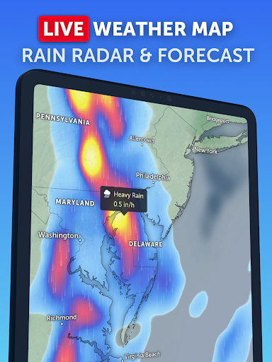
Interactive Weather Map
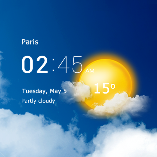
Zoom Earth features an interactive weather map that allows users to explore weather patterns across the globe. You can view live updates on rain, wind, temperature, pressure, and more, all layered seamlessly over satellite imagery. The platform enables tracking of hurricanes, tropical storms, and severe weather events as they develop and move, making it invaluable for safety and planning purposes.
Satellite Imagery
The app showcases near real-time satellite imagery updated every 10 minutes through NOAA GOES and JMA Himawari geostationary satellites. These images provide a detailed view of cloud cover, storm systems, wildfires, and smoke plumes. EUMETSAT Meteosat images refresh every 15 minutes, while NASA's polar-orbiting satellites Aqua and Terra deliver high-definition imagery twice daily. This combination ensures users have access to the latest satellite data for accurate weather monitoring.
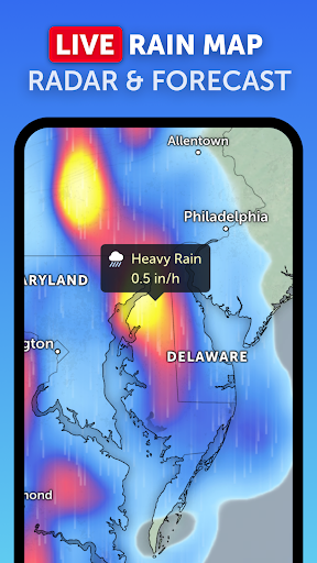
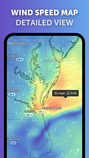
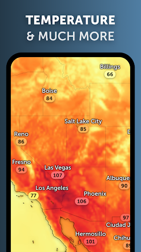
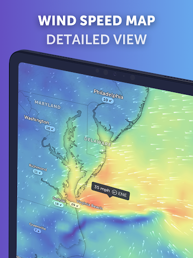
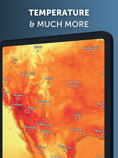
Weather Forecast Maps
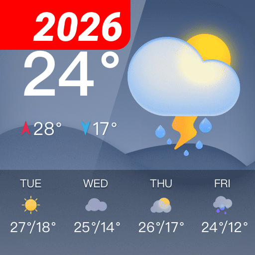
Zoom Earth offers stunning, interactive forecast maps that visualize various weather parameters. These include precipitation predictions (rain and snow), wind speed and gusts, temperature, perceived "Feels Like" temperature, humidity, dew point, and atmospheric pressure. These maps are continuously updated with forecast data from leading models like DWD ICON and NOAA/NCEP/NWS GFS. This rich visual information makes it easy to understand upcoming weather conditions and plan accordingly.
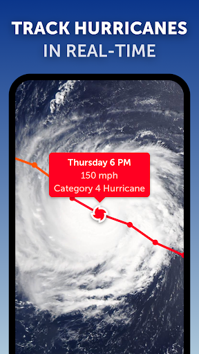
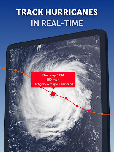
Hurricane Tracking
One of the standout features is hurricane tracking. Users can monitor tropical storms from inception to category 5 intensity in real-time, with updates from authoritative sources such as NHC, JTWC, NRL, and IBTrACS. The clear and intuitive interface allows anyone to follow the development of hurricanes and intense storms with ease, helping communities and individuals stay prepared for these powerful weather systems.
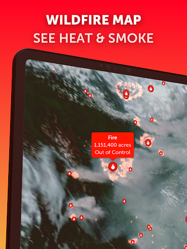
Wildfire Monitoring
Wildfire tracking is another crucial component. The app overlays active fire locations and heat spots, updated daily using data from NASA FIRMS. Coupled with GeoColor satellite imagery, users can observe wildfire smoke movement and assess fire weather conditions in near real-time. This feature is particularly valuable during wildfire seasons, assisting authorities and citizens in making informed decisions.
Customizations and Additional Features
Zoom Earth provides extensive customization options, allowing users to adjust temperature units, wind units, time zones, animation styles, and more. Advanced users can tailor their experience to suit specific needs, whether for casual weather checking or detailed scientific analysis. The app’s subscription plan, Zoom Earth Pro, unlocks additional features and benefits, ensuring a flexible experience for dedicated users.
Why Choose Zoom Earth?
If you're fascinated by weather phenomena, geography, or environmental science, Zoom Earth serves as an excellent tool to explore the planet’s dynamic climate system. Its real-time satellite imagery and detailed weather overlays make it more than just a weather app — it’s like having a weather laboratory in your pocket. Planning outdoor activities, tracking hurricanes, monitoring wildfires, or simply satisfying your curiosity about the weather across different regions has never been easier and more engaging.
With a user-friendly interface, crisp graphics, and up-to-date weather data, Zoom Earth ensures you stay informed and prepared. Whether you're a weather enthusiast, a professional meteorologist, or a traveler, this app provides critical information visually and intuitively. So, if you're looking for a live weather map with global coverage, satellite imagery, and hurricane tracking, give Zoom Earth a try — it’s your window to the world’s ever-changing weather patterns.
Pros
- High-resolution satellite imagery
- Real-time weather updates
- User-friendly interface
- Detailed weather forecasts
- Multiple map views available
Cons
- Requires internet connection
- Limited offline functionality
- Can consume high data
- Occasional slow loading times
- Ads can be intrusive