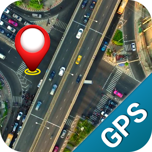


Introduction to Satellite View: Live Earth Maps
Have you ever imagined exploring the world from the comfort of your own home? Satellite View: Live Earth Maps transforms that dream into reality by offering a comprehensive and immersive experience of the planet. This innovative app combines high-resolution satellite imagery, real-time traffic updates, and 3D terrain views to provide users with an engaging virtual journey around the globe. Whether you're a travel enthusiast, a geography buff, or simply curious about unfamiliar locations, this application is designed to cater to all your exploration needs.
Key Features of Satellite View: Live Earth Maps
Real-Time Satellite and Street Views
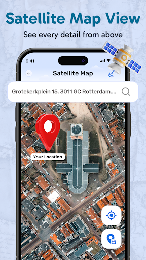
This app provides stunning live satellite imagery that allows you to zoom into any corner of the world with high clarity. You can also explore live street views, offering a ground-level perspective of cities, landmarks, and natural wonders. The ability to switch seamlessly between satellite and street views makes it an invaluable tool for planning trips or satisfying your curiosity about remote locations.
3D Terrain and Landmark Visualization
Experience the earth in three-dimensional detail through detailed terrain maps of cities and mountain ranges. The 3D views help you get a realistic sense of topography and elevation, perfect for virtual hiking or exploring famous landmarks before visiting in person.
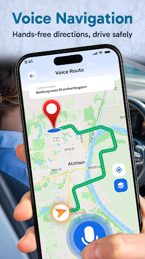
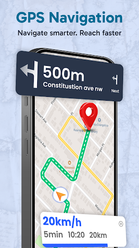
Navigation and Routing
The built-in GPS route finder instantly locates your position on the map and provides accurate directions for driving, walking, or cycling. Whether you need quick routes or detailed directions, this feature ensures a stress-free journey. Bus route maps further assist travelers in public transportation planning.
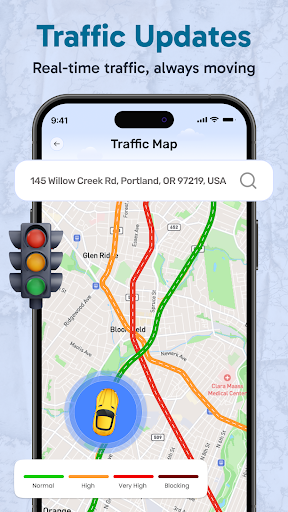
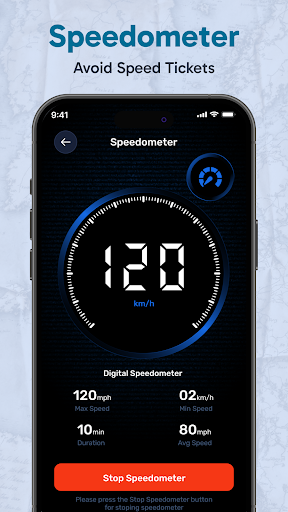
Live Traffic and Weather Updates
Stay ahead with real-time traffic updates that help you avoid congestion and plan your route efficiently. The weather overlay provides current weather conditions worldwide, making outdoor planning easier and more informed. For astronomy fans, an optional astronomical view mode allows for a stargazing experience.
GPS Camera and Photo Features
Capture memorable moments with your device's camera while recording GPS information such as location, date, and time. Organize your travel memories and share your discoveries effortlessly, thanks to integrated GPS data tags.
Search and Explore
Effortlessly find cities, streets, and landmarks with the intuitive search function. The app's global coverage ensures you can find real-time details for numerous locations worldwide, perfect for virtual explorers and serious travelers alike.
Why Choose Satellite View: Live Earth Maps?
This app is more than just a map; it's an interactive global explorer. Its fast-loading maps and comprehensive features make it suitable for casual browsing or detailed planning. Travel enthusiasts can virtually tour iconic landmarks or discover new places, while professionals can utilize accurate routing for logistics or fieldwork.
The live satellite data is continuously updated, ensuring you get the latest imagery and traffic information. The versatility to switch between detailed satellite images, street-level photographs, and 3D terrain views caters to diverse interests. Whether you're exploring famous rivers, mountain ranges, urban sprawls, or natural environments, this app delivers a captivating perspective of Earth.
With its user-friendly interface and powerful features, Satellite View: Live Earth Maps is an essential tool for explorers, travelers, and anyone eager to learn more about our planet's incredible diversity. Download it today and unlock the world at your fingertips, anytime and anywhere.
Pros
- Provides real-time satellite imagery.
- Easy navigation with an intuitive interface.
- Offers street, terrain, and hybrid views.
- Includes weather overlay for forecasts.
- Frequent updates with new data.
Cons
- High data consumption on mobile networks.
- Limited offline map access.
- Occasional delays when loading images.
- Some features require in-app purchases.
- May deplete battery rapidly.


