


Earth 3D Map-StreetView Camera Overview
Have you ever wanted to explore the world from the comfort of your couch? With Earth 3D Map-StreetView Camera, you can do just that. This innovative application functions as your personal digital tour guide, enabling you to virtually visit any corner of the globe with just a few taps on your device. Whether you're a travel enthusiast, a geography student, or simply curious about different places, this app offers a rich, immersive experience that makes exploring the Earth both engaging and educational.
Key Features of Earth 3D Map-StreetView Camera
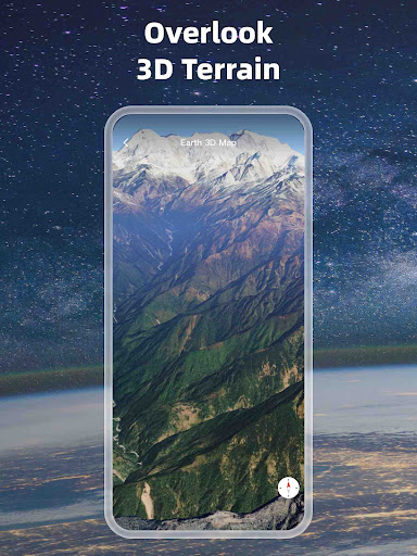
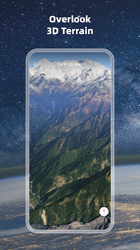
Stunning High-Definition 3D Globe
The app provides a high-definition 3D globe visualization that transforms traditional maps into vibrant, realistic landscapes. This feature helps users experience a lifelike representation of the Earth's surface, including terrain, forests, rivers, lakes, buildings, and roads. The detailed rendering makes it feel as if you are actually flying over continents and oceans, providing an immersive exploration experience.
Advanced Map Data Loading & Supported Formats
Earth 3D Map supports loading extensive map tile data and a variety of file formats for managing GIS project files. Supported formats include kml/kmlz, gpx, CAD (dxf, dwg), shp, csv, and geojson. This flexibility allows users to incorporate custom data and manage geographic information system (GIS) files efficiently, making it a powerful tool for professionals and hobbyists alike.
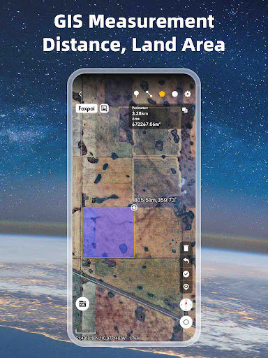
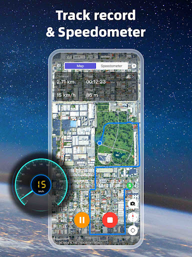
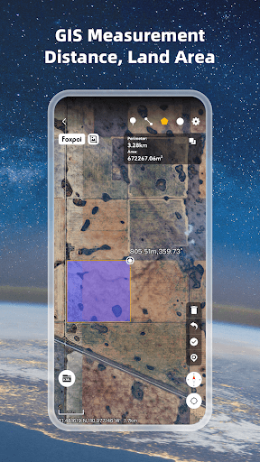
Navigation and Measurement Tools
The app features an intuitive compass function for orientation and tools to measure area and distance. Whether you wish to calculate the size of a land parcel or estimate travel distances, these built-in tools enhance your ability to analyze geographic data directly within the app.
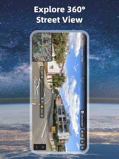
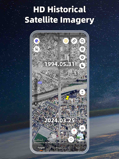
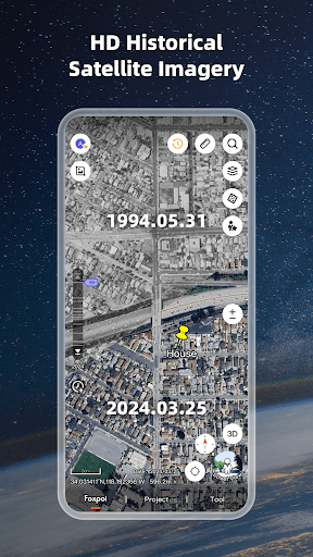
Real-Time Satellite Imagery & Globe Views
With access to latest satellite imagery, users can explore current surface conditions around the world. The app offers world map and satellite map views, enabling seamless switching between different perspectives. Additionally, it supports supported formats such as kml/kmz, gpx, and more, providing comprehensive options for geographic data visualization.
Global Coverage & Regional Details
Earth 3D Map covers a vast array of countries and regions including United States, China, India, Brazil, Russia, Australia, South Africa, and many others. This extensive coverage ensures you can virtually explore popular tourist destinations or lesser-known locales across the globe with intricate detail.
Coordinate Systems & Geographic Data
The app supports various coordinate systems such as UTM and MGRS, allowing for precise geographic positioning and advanced mapping tasks. This makes Earth 3D Map a versatile tool for both casual users and GIS professionals looking to analyze spatial data with accuracy.
Experience the World Virtually
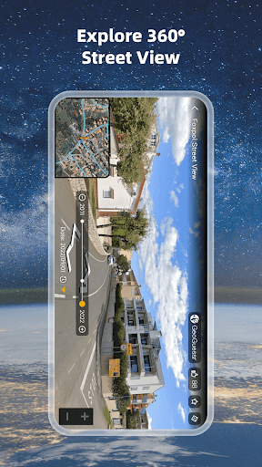
Earth 3D Map allows you to explore the world using satellite photos that showcase surface terrain, urban landscapes, rivers, forests, and landmarks in remarkable detail. It offers an advantage over conventional maps by providing a realistic view of the Earth's surface, making virtual travel more authentic. Whether you're planning a trip, studying geography, or satisfying your wanderlust, this app makes it easy to venture across the globe without leaving your home.
Coverage and Accessibility
The app supports numerous countries and regions, from United Kingdom and Canada to India, Brazil, South Korea, and many more. This extensive regional support ensures a comprehensive exploration experience, catering to users worldwide. The intuitive interface coupled with smooth performance means you can navigate easily and analyze geographic data efficiently.
Conclusion
Earth 3D Map-StreetView Camera is the ultimate digital travel companion for armchair explorers and GIS professionals alike. Its stunning 3D visualization, seamless integration of Street View, support for a wide range of data formats, and detailed global coverage make it a versatile tool for immersive geographic exploration. Whether you're interested in virtual sightseeing or managing GIS projects, this app offers a powerful, user-friendly platform to discover the world from your fingertips. Download now and embark on your virtual journey to explore the wonders of our planet today!
Pros
- Interactive 3D maps improve exploration.
- Street view provides real-time navigation.
- Intuitive interface simplifies usage.
- Supports offline maps for remote locations.
- Regular updates introduce new areas.
Cons
- High data consumption when using live street view.
- Occasional delays in 3D map rendering.
- Limited options for customization.
- Advertisements can sometimes be disruptive.
- Some regions do not have street view coverage.


