Discover the Ultimate GPS Satellite Live Earth Map Experience
Are you passionate about exploring the world in stunning detail or in need of reliable navigation tools? The GPS Satellite Live Earth Map app is your perfect travel companion, offering an immersive 360-degree satellite map exploration, live earth map HD visuals, and advanced navigation features. Whether you're navigating through a bustling city or discovering remote natural landscapes, this app brings the globe to your fingertips with realistic high-resolution imagery and real-time mapping capabilities.
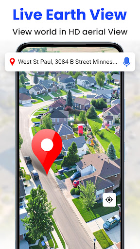
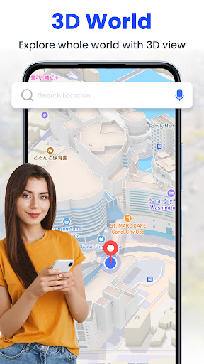
Explore the Globe in 3D and Live Satellite View
Experience the world like never before with high-resolution 3D satellite views and live earth maps. The app provides detailed visualizations of landmarks, cities, and terrains from a bird's-eye perspective. It allows your device to show real-time updates, delivering an accurate representation of remote locations and urban environments. This feature is perfect for casual explorers, students, or travelers planning their trips, as it offers a realistic glimpse into countless destinations worldwide.
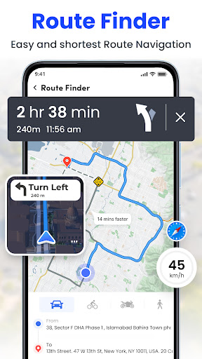
Advanced GPS Navigation and Real-Time Routing
Stay on the right track with turn-by-turn GPS navigation and route planning. The app guides you through your journey, providing voice prompts and clear directions to reach your destination safely and efficiently. With live street maps, you get detailed information about road conditions, traffic congestion, and the best routes to avoid delays. Planning a trip to new locales or finding nearby facilities such as restaurants, hotels, or ATMs has never been easier, thanks to the app's integrated location services.
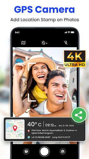
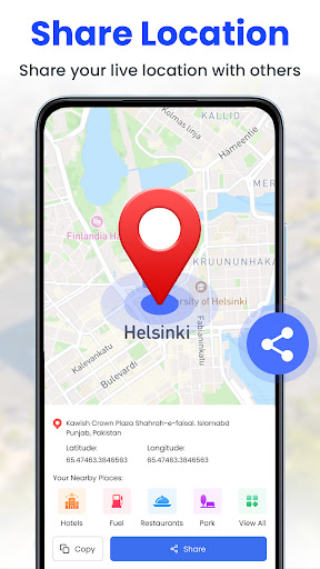
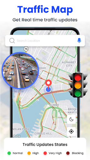
Real-Time Maps and Live Location Sharing
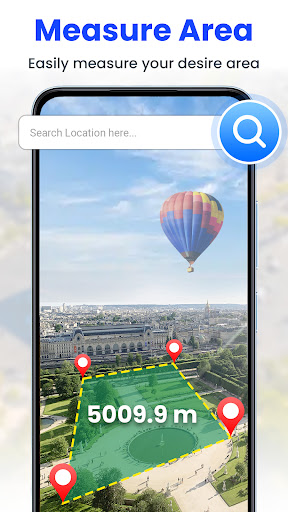
Get a first-person view with detailed street maps and live location updates. View street names, landmarks, and neighborhood details, making it simple to navigate complex city layouts or explore familiar areas. The map’s interactive layers allow you to zoom, switch views, and measure land areas, which is perfect for urban planning or property evaluation. With live traffic alerts, you can avoid congestion and plan your routes accordingly, ensuring seamless travel in busy areas.
Key Features for Enhanced Exploration
- 360 satellite coverage providing a full view of the Earth
- High-resolution 3D imagery for immersive visual experience
- Speedometer showing max and average speeds during travel
- Interactive compass for accurate direction finding
- Live earth map HD with up-to-date terrain and city data
- Real-time maps for precise navigation and tracking
- GPS route maps and navigation for seamless trip planning
- Area measurement feature for measuring land or property sizes
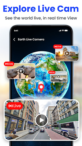
Explore Virtually with Live Satellite View
Curious about specific locations without leaving your home? The Live Satellite View feature allows you to explore anywhere in the world virtually, from city streets to natural landscapes. Imagine zooming into your favorite city or checking out a sightseeing spot before visiting. The app provides a bird's eye view with remarkably clear imagery, making virtual exploration engaging and informative. With the 3D street view feature, you can navigate through neighborhoods and even walk down streets virtually, providing a realistic preview of your destination.
User-Friendly Interface and Seamless Experience
The app boasts an intuitive and accessible design, making navigation straightforward even for those unfamiliar with advanced mapping tools. Quick loading times, smooth controls, and seamless integration of real-time traffic data ensure you always have the latest information. Whether you're planning a trip or simply exploring places of interest, the user experience is optimized for speed and ease of use. Customizable map settings and layer toggles further enhance your exploration journey.
Perfect for Travelers, Commuters, and Explorers
In today’s fast-paced world, GPS Satellite Live Earth Map stands out as a reliable tool for everyone — from regular commuters to global travelers. Its comprehensive features enable you to explore, navigate, and stay informed about your surroundings effortlessly. Whether you're discovering new destinations, retracing your steps in familiar territory, or simply satisfying your curiosity with virtual globe exploration, this app makes every journey more connected and enjoyable. With up-to-date imagery and precise location services, it truly brings the world to your device.
Pros
- Access to real-time satellite imagery
- Accurate GPS navigation features
- User-friendly interface design
- Availability of offline maps
- Periodic updates with new data
Cons
- Limited free features available
- High data usage on mobile devices
- Occasional delays in loading maps
- Advertisements present in the free version
- Battery consumption increases with extended use


