Discover the Power of Tagofy - Geotag Map Camera
Are you passionate about capturing travel memories and documenting special places with geographical accuracy? Tagofy - Geotag Map Camera is an innovative app designed for both Android and iOS devices that elevates your photography experience by embedding precise geotags and detailed location data directly into your photos. Whether you’re exploring iconic landmarks, scenic landscapes, or your own city streets, this app allows you to preserve every moment with rich contextual information, making your travel albums more meaningful and shareable.
Seamless Photo Capture with Embedded Geographical Data
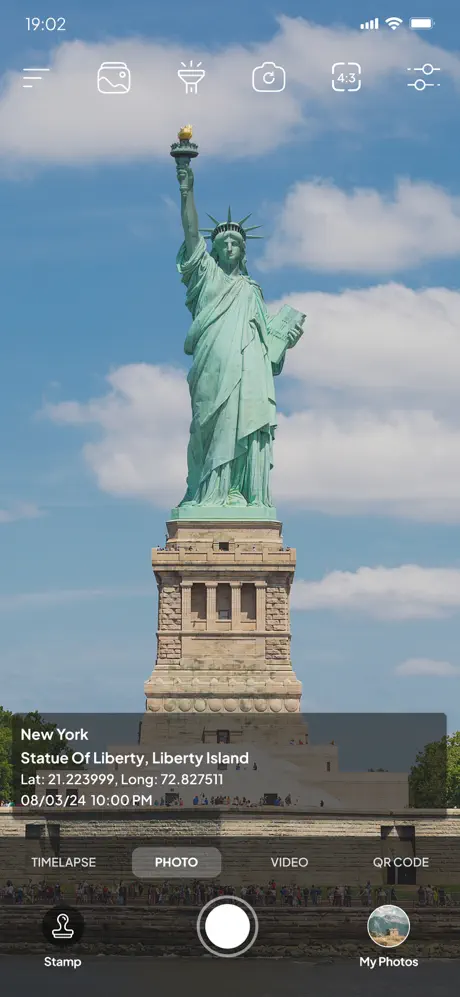
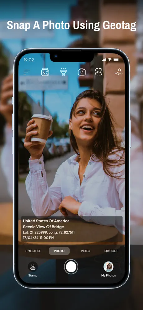
One of the standout features of Tagofy - Geotag Map Camera is its ability to automatically attach location information to your photos as you take them. Imagine standing at the edge of the Grand Canyon or strolling through historic streets — with a simple tap, your camera captures not just the image, but also the latitude, longitude, altitude, and even weather conditions at that exact moment. This integration makes it effortless to keep a detailed record of your adventures without manual input or complicated processes.
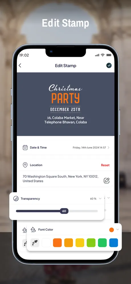
Intuitive Customization and Advanced Features
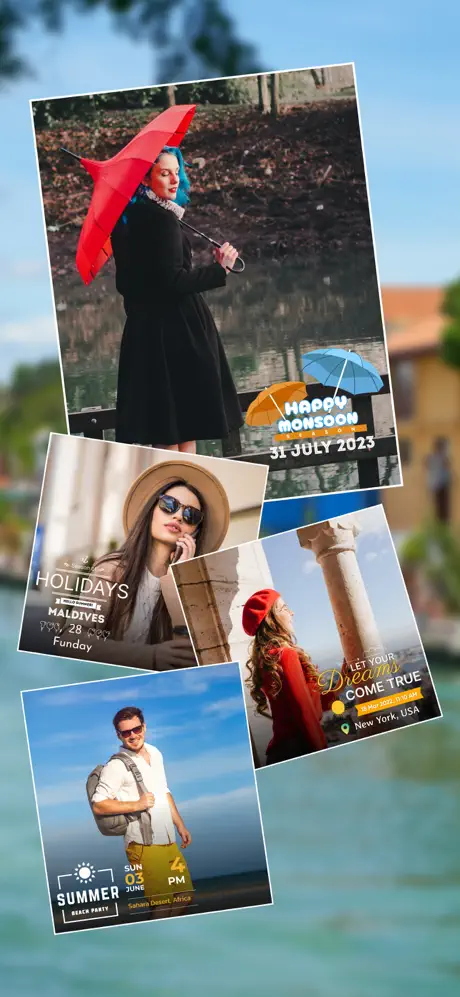
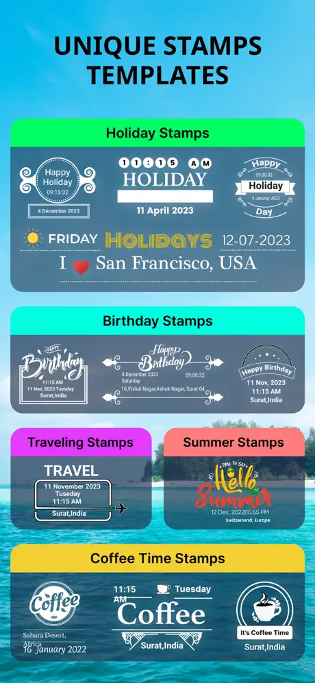
The app provides powerful customization options tailored to meet the needs of avid photographers and explorers. With tools to adjust watermark formats, incorporate timestamps, and personalize the stamp layout, you can create images that reflect your style. Unique features such as automatic location data setting ensure that each photo is tagged accurately, even in offline mode. Additional functionalities include high-quality video recording, with adjustable settings for format, bitrate, and stabilization, as well as features like time-lapse video creation and mirror front camera support.
Geotagging and Location Sharing Made Easy
Sharing your travel moments has never been easier. Tagofy allows you to embed geotags directly into your photos, making each image a mini map of your journey. Whether you want to display street views, landmarks, or scenic vistas, the app’s GPS camera feature automatically adds the precise location along with additional data like address, date, and time. Using the app, you can create well-organized photo albums based on locations and easily share these memories via social media, email, or messaging platforms, complete with embedded hashtags for better discoverability.
Custom Template and Personalization Options
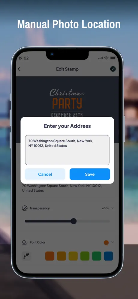
For a more personalized touch, the Advanced Template section offers options to add custom details such as:
- Address: Add or manually input location info.
- Date & Time: Display timestamps in various formats.
- Logo: Upload your own branding or personal logo for a professional touch.
- Notes: Attach descriptions or notes to your photos.
- Hashtags: Organize your images with relevant tags for easy searchability.
Benefits of Using Tagofy - Geotag Map Camera
This app is not merely a photography tool; it’s a comprehensive travel companion that helps you document, organize, and share your experiences with rich geographical context. Key benefits include:
- Accurate GPS location stamps to highlight your visits.
- Photo and video geotagging to preserve exact whereabouts.
- Offline functionality allowing location logging even without internet access.
- Lightweight operation that conserves battery life and storage.
Transform Your Travel Photography with Tagofy
Imagine your photos not only as visual keepsakes but also as detailed stories tagged with real-time location data. With Tagofy - Geotag Map Camera, you can turn every snapshot into a geotagged memory, perfect for travel blogging, social sharing, or simply keeping a personal journal of your adventures. Its user-friendly interface, extensive customization options, and reliable geotagging features make it a must-have for explorers and storytellers alike. Whether you’re capturing city strolls, mountain hikes, or family gatherings, this app ensures your photos are enriched with context, making your travel memories last a lifetime.
Pros
- Easy geotagging for photos
- User-friendly interface
- Supports multiple languages
- Customizable watermark options
- Works offline effectively
Cons
- Limited editing features
- Requires large storage space
- Occasional GPS inaccuracies
- Ads in free version
- Limited cloud integration