


GPS Satellite Maps: Live Earth – Your Ultimate Navigation Companion
Discover the power of GPS Satellite Maps: Live Earth, a cutting-edge all-in-one navigation application designed to simplify your journeys. Whether you're commuting daily, planning a road trip, or exploring new cities, this app provides a comprehensive suite of features to enhance your travel experience. From live traffic updates to advanced mapping tools, GPS Satellite Maps: Live Earth is your reliable travel partner.
Key Features to Elevate Your Navigation Experience
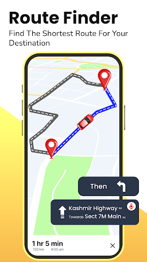
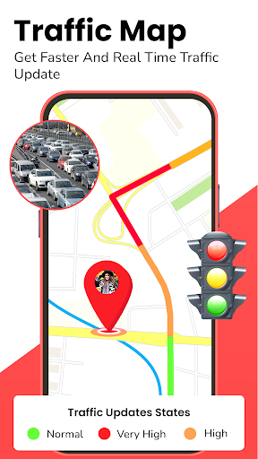
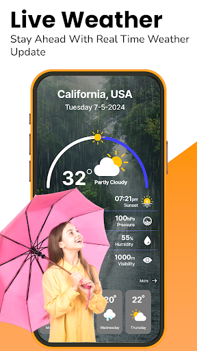
Real-Time Traffic & Dynamic Route Planning
Stay ahead of traffic congestion with live traffic updates that highlight congested areas on your route. Our app intelligently suggests alternative pathways, helping you avoid delays and reach your destination faster. The interactive driving route map makes it easier than ever to find the most efficient route without manual planning.
Accurate GPS & Turn-by-Turn Directions
Whether you travel by car, bike, or on foot, our precise GPS and turn-by-turn navigation guide you effortlessly to your destination. Forget about getting lost—our reliable algorithms ensure every journey is smooth, accurate, and stress-free.
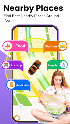
Enhanced Points of Interest & Local Discoveries
Discover nearby points of interest such as restaurants, cafes, gas stations, banking facilities, and tourist attractions. Use our extensive database to uncover hidden gems, iconic monuments, and scenic spots, making your trips more memorable and explorative.
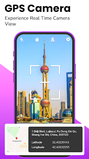
GPS Camera & Live Map Features
Our gps camera gps map live feature allows you to embed location data directly onto images, perfect for sharing your adventures or capturing memorable moments tied to specific locations. The gps camera lite version enables quick and easy photo tagging with embedded location details.
Public Transportation & Subway Maps
Navigate cities with integrated subway maps for various major metropolitan areas worldwide. Access detailed information on routes, stations, and transfer points, simplifying public transportation travel in unfamiliar cities.
Why Choose GPS Satellite Maps: Live Earth?
Designed with user experience in mind, the app features an intuitive interface that makes navigation effortless. Its up-to-date maps and reliable navigation algorithms ensure both precision and dependability on every trip. Whether traversing urban jungles or remote landscapes, GPS Satellite Maps: Live Earth keeps you oriented and informed.
Personal Experience & User Satisfaction
Many users, including myself, find that GPS Satellite Maps: Live Earth transforms the way we explore the world. On a recent road trip, I relied on its accurate GPS tracking and real-time traffic updates. It even suggested some scenic detours, turning a routine trip into a memorable adventure. Offline map features proved invaluable in areas with poor internet connectivity, ensuring seamless navigation at all times.
Embark on Your Next Adventure Today
With GPS Satellite Maps: Live Earth, exploring new places becomes effortless and enjoyable. Whether you're navigating urban streets, discovering points of interest, or traveling by public transport, this app empowers you to explore with confidence and convenience. Download it now and unlock a world of seamless navigation and exciting adventures at your fingertips!
Pros
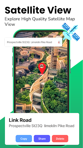
- High-resolution satellite imagery
- Real-time GPS tracking feature
- User-friendly interface
- Offline maps available
- Regular updates with new features
Cons
- Consumes significant battery power
- Requires internet for live updates
- High data usage for satellite view
- Ads can be intrusive
- Limited customization options


