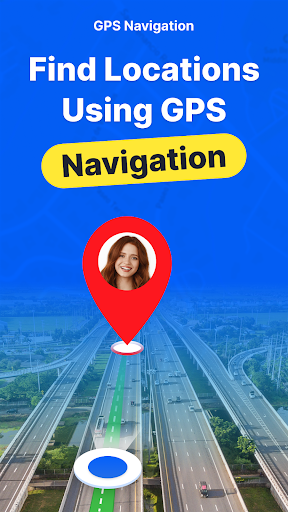


Introduction to GPS Earth Maps Live Navigation
Discover the ultimate navigation companion with GPS Earth Maps Live Navigation. This innovative app transforms the way you explore and travel by providing efficient route planning, real-time traffic updates, and a comprehensive satellite view. Whether you're navigating through busy city streets or remote rural areas, this app ensures you stay on track with precise directions and helpful features designed for a seamless experience.
Core Features of GPS Earth Maps Live Navigation
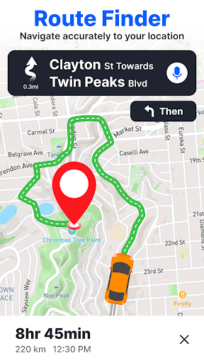
Real-Time Navigation and Live Traffic Alerts
The core of GPS Earth Maps Live Navigation lies in its real-time navigation system that offers shortest routes tailored to current traffic conditions. It alerts you about traffic jams and roadblocks, thereby enabling smarter route decisions, saving you time and fuel. The integration of global traffic updates keeps you informed no matter where you are, allowing for dynamic rerouting if needed.
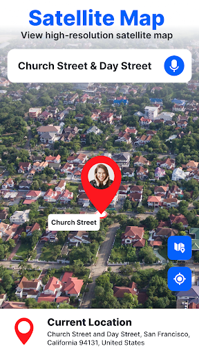
Satellite Views and Earth Map Integration
Experience realistic and detailed satellite imagery with multiple map modes, including night mode, terrain, and normal view. The app's earth maps feature allows users to pinpoint exact locations like their house or famous landmarks on the satellite GPS map, providing a complete view of the surroundings. Tourists and explorers will love exploring renowned destinations with high-resolution satellite imagery, making travel planning more engaging than ever.
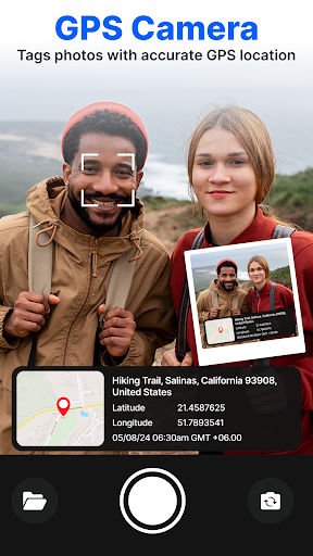
Precise Location Sharing and GPS Coordinates
Identify your current position accurately with latitude and longitude details, and effortlessly share your location with friends or family. This feature ensures safety and convenience during travels, whether for emergency sharing or confirming a meetup point.
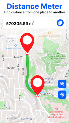
Voice Navigation and Distance Calculation
Navigate effortlessly with intuitive voice commands that help you search for destinations hands-free. Additionally, the app can calculate the distance between any two points, aiding you in trip planning and ensuring you stay informed about travel distances in both kilometers and meters.
Speed Monitoring and Safety Alerts
Stay safe on the road using the built-in GPS speedometer which displays your current speed in Km/h. With over-speed alerts, you can maintain safe driving habits, and the speedometer also proves useful during activities like cycling, running, flying, or sailing.
Additional Tools for Travel Planning
The app features a versatile GPS area calculator that lets you measure distances between multiple points by simply clicking on locations on the map. You’ll also get an accurate【angular inclination】measurement to assess terrain elevation, which is ideal for outdoor explorers and adventurers.
Enhanced User Experience for Explorers and Tourists
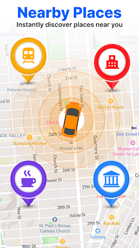
If you’ve ever struggled with getting lost in unfamiliar territory, GPS Earth Maps Live Navigation is your perfect travel buddy. Its user-friendly interface makes searching for places, setting routes, and exploring landmarks straightforward and fun. The app offers detailed street views, satellite imagery of popular tourist attractions, and real-time traffic conditions, ensuring you’re well-prepared for every journey.
It’s especially helpful for tourists wanting to locate famous landmarks effortlessly. By searching the name of the location, users can immediately access high-quality satellite images, detailed directions, and even street-level views. This comprehensive visual guidance enhances your exploration experience, making every trip memorable.
Convenience and Safety for All Types of Travel
Whether you’re driving, cycling, running, flying, or sailing, the GPS Earth Maps app adapts to your activity by providing real-time speed monitoring and safety alerts. Download offline maps to continue navigating in areas without cell service, making this app an ideal choice for outdoor adventures or international travels.
The integrated features like route saving, favorites, and detailed map types ensure that your navigation is tailored to your preferences, improving overall travel convenience. With its accurate GPS positioning, route guidance, and multi-functionality, traveling abroad or locally has never been easier or more enjoyable.
Conclusion
GPS Earth Maps Live Navigation stands out as a highly reliable, feature-rich navigation solution designed to make your travel safer, easier, and more enjoyable. With quick access to global and local maps, real-time traffic updates, precise GPS positioning, and innovative tools like the area calculator and inclination measurement, this app truly redefines mobile navigation. If you're seeking a versatile navigation app that combines satellite imagery, voice-guided directions, and safety features, give GPS Earth Maps a try — it’s your perfect companion everywhere you go.
Pros
- Accurate real-time GPS tracking
- Extensive global map coverage
- Intuitive and easy-to-use interface
- Supports offline maps
- Voice-guided navigation system
Cons
- Frequent advertisements interrupt usage
- High battery consumption
- Some maps require in-app purchases
- Occasional app crashes reported
- Limited options for customization