


Explore the Vastness of Public Lands with the BLM Public Lands Map Guide USA
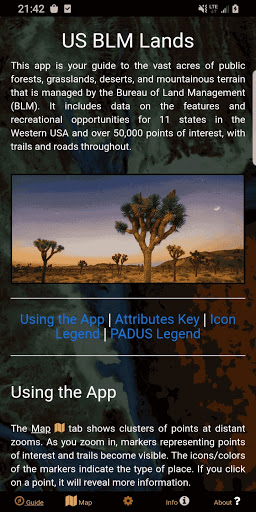
The United States of America is renowned for its diverse landscapes, from lush forests and stunning deserts to breathtaking vistas and rich historical sites. While many travelers are familiar with iconic landmarks, few realize the extensive expanse of public Bureau of Land Management (BLM) lands that stretch across the western United States. The BLM Public Lands Map Guide USA is a powerful app designed to help outdoor enthusiasts discover and explore these vast natural treasures seamlessly. Whether you're a seasoned explorer or a casual nature lover, this app is your ultimate navigational companion to unlock the wilderness and recreational opportunities across America’s public lands.
Comprehensive Data for Unmatched Outdoor Exploration
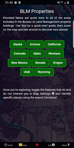
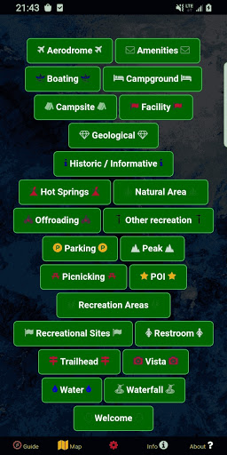
As of the Summer 2024 update, the app boasts a database featuring over 52,000 recreational points spread across BLM-managed properties. The data encompasses a wide range of features, including Access Points, Boating Locations, Campgrounds, Points of Interest (POIs), Vistas, Bathrooms, Parking Lots, Recreational Areas, and more. To enhance user experience, the app utilizes color-coded icons to distinguish between different point categories, making planning and discovery straightforward. It even incorporates property boundaries, hiking trails, and roads, giving users a detailed map to easily navigate remote areas and plan adventures with confidence.
Customizable and User-Friendly Features for Every Explorer
One of the standout qualities of the BLM Public Lands Map Guide USA is its intuitive design. It features five main screens to help users access essential functions quickly. The Guide screen offers helpful tips and data legends to optimize navigation. The Info screen provides spatial links and details about specific BLM lands, allowing users to locate their next hiking trail or scenic viewpoint easily. The About screen connects to open-source resources used within the app, as well as information about the developer, GeoPOI. The Map Settings screen offers customization options, such as switching between four base maps, downloading offline imagery, enabling geolocation, and toggling categories for a tailored view.
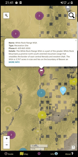
Dynamic Map Experience with Clusters and Search Tools
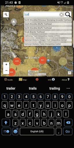
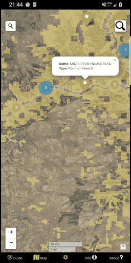
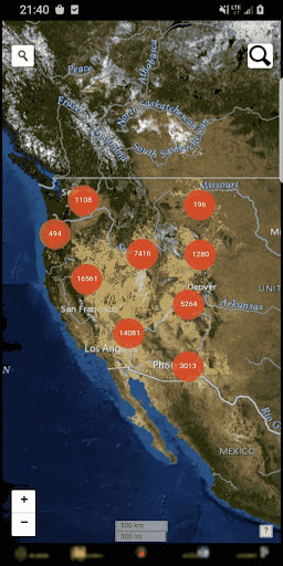
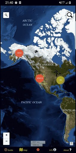
The Map screen is where all the features converge. It visually displays points with cluster symbols at wider zoom levels, indicating the number of points within a package. As you zoom in or tap on clusters, individual icons and trails become visible, revealing detailed information like names, locations, and features. The map also provides two powerful search tools: one for address and town lookup, and another for querying specific feature names within the database. This combination allows for easy discovery and precise planning of outdoor activities—be it camping, hiking, or scenic driving.
Enhanced Navigation and Personalization
Navigating America’s public lands has never been easier. The app includes functions such as offline map downloads, so adventurers can venture into remote areas without relying on cellular service. The custom My Points tool enables users to create their own points with personalized icons and colors, and even export these points to share with others or for future reference. Whether you’re marking a favorite camping spot, a trailhead, or a scenic vista, this feature enhances personalization and trip planning.
Why Choose the BLM Public Lands Map Guide USA?
This app transforms the way outdoor enthusiasts discover and enjoy public lands across the United States. Its comprehensive data, user-friendly interface, customizable options, and detailed maps make it an indispensable tool for exploring natural and cultural sites managed by the Bureau of Land Management. Whether you’re seeking a quiet camping retreat, an adventurous hiking trail, or a scenic drive through iconic landscapes, this app provides all the tools to plan and execute your outdoor adventures effortlessly. Embrace the natural beauty of America’s vast public lands and let the BLM Public Lands Map Guide USA be your guide to discovering the wilderness that makes this nation truly exceptional.
Pros
- Comprehensive coverage of public lands on the map.
- Intuitive interface that is easy to navigate.
- Offline maps accessible for remote areas.
- Updated regularly with new data.
- Detailed information on trails and campsites.
Cons
- Full access requires a subscription.
- GPS accuracy can occasionally be imprecise.
- Limited interactive features.
- High battery consumption on mobile devices.
- Initial setup process may be lengthy.