
Overview of NZ Topo50 Offline - North
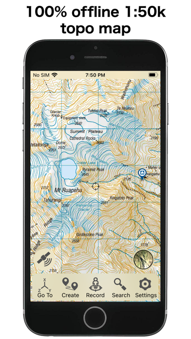
The NZ Topo50 Offline - North app provides comprehensive offline topographic maps coverage of the entire North Island of New Zealand. Built on the LINZ NZTopo50 series maps, it delivers a seamless navigation experience without the need for internet access. With fully included maps upon installation, users can enjoy pan and zoom functionalities across all terrains without additional downloads, account signups, or hidden fees. This makes it an ideal tool for backcountry navigation, whether you're trampers, hikers, bikers, runners, hunters, or involved in search and rescue missions.
Key Features for Outdoor Enthusiasts
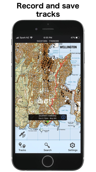
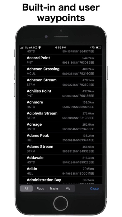
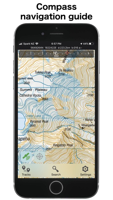
Designed with outdoor adventurers in mind, the app boasts various navigation functions. It includes GPS positioning to track your location precisely, track logging to record your routes, and options for user waypoints marking important spots. The built-in compass provides orientation, while altitude and speed displays help monitor your progress. You can easily measure distance and bearing to any points on the map, fostering safer and more efficient navigation. Additionally, the app supports route creation and following, allowing users to plot and adhere to planned courses.
Enhanced Map Search and Data Integration
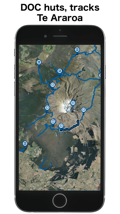
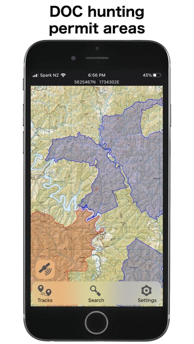
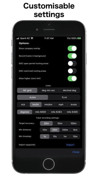
Searching for specific locations is straightforward with the app’s capability to search and zoom to named places and features. Users can import, export, and share tracks and waypoints in popular formats like kml and gpx, enabling easy data management and route sharing. Furthermore, the app overlays valuable information such as the DOC open permit hunting boundaries, the Te Araroa trail, and other relevant data layers, enriching the navigation experience for outdoor users.
Precision in Mapping and Data Accuracy
The app is specially built to align with the New Zealand national map grid, avoiding the common distortions associated with the global WGS84 datum. This ensures that gridlines remain perfectly parallel when overlaid on LINZ maps, providing reliable and accurate navigation. The reliance on accurate national grid data makes it highly suitable for serious outdoor activities and enhances the credibility of the topographic information provided.
Offline Reliability and Storage Considerations
One of the standout aspects of NZ Topo50 Offline - North is its offline capability—no internet connection is necessary to operate the full suite of maps and navigation functions. This makes it invaluable for remote areas where cellular service might be absent or unreliable. However, users should be aware that the app requires a reasonable amount of storage space, so ensuring sufficient device capacity beforehand is recommended.
Ease of Use and User Experience
The app features a clean and intuitive interface, allowing users to quickly get started with minimal setup. It loads maps rapidly, and the high-resolution visuals remain clear even in direct sunlight, which is crucial during outdoor adventures. Setting up your routes, marking waypoints, or adjusting settings can be done with just a few taps and swipes, making this app accessible to both seasoned navigators and newcomers. Its efficient resource usage also means your device’s battery life is preserved during extended trips.
Why Choose NZ Topo50 Offline - North?
If you are planning to explore the scenic trails, rugged terrains, or remote wilderness of New Zealand's North Island, NZ Topo50 Offline - North is your ideal digital companion. It combines detailed, accurate topographic mapping with robust offline functionality, making navigation straightforward and reliable in any environment. With features tailored for outdoor lovers—such as route planning, data sharing, and layered overlays—this app empowers you to venture further with confidence. Whether hiking, biking, hunting, or simply discovering new spots, this app ensures you're well-equipped for every outdoor adventure. Pack your gear, download the maps, and let this reliable navigation tool guide you through New Zealand’s breathtaking landscapes.
Pros
- Offline access to detailed topographic maps.
- User-friendly interface for easy navigation.
- Regular updates with new map data.
- Comprehensive coverage of North New Zealand.
- Works without an internet connection.
Cons
- Limited to North New Zealand region.
- May require storage space for offline maps.
- No real-time GPS tracking available.
- Paid app with no free version option.
- Interface may be overwhelming for beginners.


