
Overview of Mgrs & Utm Map Pro
Introducing Mgrs & Utm Map Pro, a powerful navigation application tailored for outdoor enthusiasts, professionals, and anyone who needs precise location data. This app transforms your smartphone into a sophisticated GPS and coordinate systems helper, supporting various satellite navigation systems like GPS, GALILEO, and GLONASS (GNSS). Whether you're mountain climbing, trekking, engaging in hunting, fishing, geocaching, off-road navigation, or scouting, this app provides comprehensive tools to enhance your outdoor experience.
The app's primary strength lies in its ability to work seamlessly with multiple map layers, offering detailed topographical views, satellite imagery, and night mode. Its versatile feature set makes it an essential companion for navigating challenging terrains or exploring new areas, all while ensuring your position is accurate and easily accessible.
Special Features at the Pro Version
The pro version of Mgrs & Utm Map Pro unlocks a suite of advanced features designed for serious users:
- Access to more maps including Bicycle, Topographic, Neighborhood, Atlas, and others.
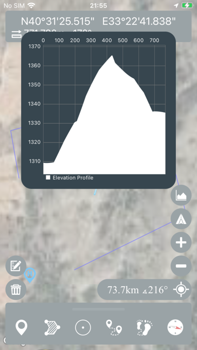
- You can view the altitude profile of your route on an interactive chart, helping you understand elevation changes.
- Ability to search for locations by address or coordinate formats.
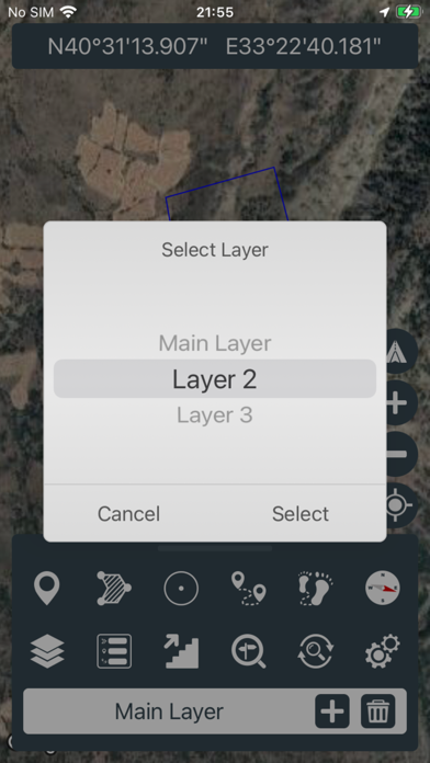
- You can create different layers for various activities such as hiking, camping, or surveying.
- List view for markers, routes, areas, and KML files simplifies management and planning.
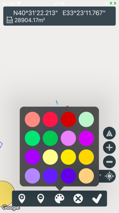
- Draw and customize multiple routes and areas and easily change their colors for clear differentiation.
- Use more colorful pointer icons and customize name or icon display options for markers.
- The GPS recorder can record multiple routes, perfect for tracking your journeys over time.
- And importantly, the pro version is ad-free, providing an uninterrupted navigation experience.
This upgraded version makes the app suitable not only for casual outdoor activity but also for professional use where detailed mapping and data management are critical.
Key Features & Capabilities
Designed with ease of use in mind, Mgrs & Utm Map Pro offers a broad array of features that enhance navigation accuracy and user convenience:
- Easy and faster navigation with an intuitive interface.
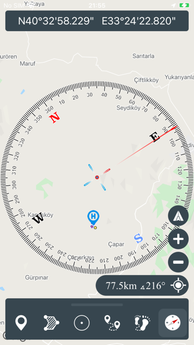
- Compass options include on-map compass that shows your direction, physical compass only, and angular units like degrees, grads, and mils.
- Follow Mode keeps your location centered on the map as you move.
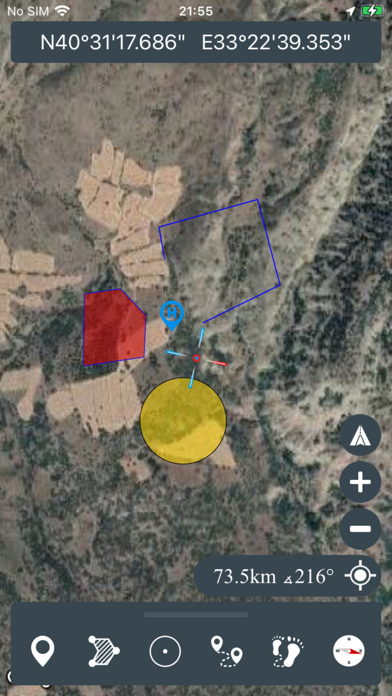
- Option to add and remove markers for waypoints or points of interest.
- Measure distance by creating custom routes, and calculate total distances.
- Calculate area by selecting regions on the map in square meters.
- View altitude of your current location for elevation-awareness.
- Find locations using different coordinate formats like Address, Degree/Minute/Second, MGRS, UTM, or Latitude/Longitude.
- Options to customize location coordinate units and distance units (meters or feet).
- Supports KML layers for export/import and layered map management.
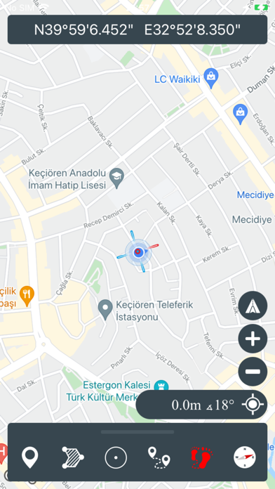
- Multiple map types are available, including Road, Terrain, Satellite, Night Mode, and Hybrid.
- Share your current location coordinates easily via various platforms.
Designed for Outdoor Adventures and Professional Use
Mgrs & Utm Map Pro is especially valuable when you're in remote locations, where traditional navigation tools may fall short. Its support for MGRS and UTM systems provides ultra-precise coordinate pinpointing, vital for military personnel, rescue teams, and serious explorers who require exact positioning.
Imagine you're on a mountain hike, trying to find a specific waypoint or assessing your route's elevation profile—this app makes it straightforward. Its offline map capabilities ensure you won't get lost due to lack of internet connectivity, which is common in wilderness areas. Planning your route in advance by downloading maps is simple, making it reliable even in the most remote spots.
Overall, Mgrs & Utm Map Pro combines user-friendly design with advanced mapping features. It supports multiple coordinate systems, facilitates detailed route planning, and offers various map views, which are invaluable for outdoor sports, professional surveying, or tactical missions. Whether you're a hiker, scout, researcher, or military personnel, this app is an indispensable navigation tool. Its reliability, precision, and intuitive interface empower users to explore with confidence, ensuring safety and efficiency throughout their adventures.
Pros
- Highly accurate GPS tracking.
- User-friendly interface.
- Offline maps available.
- Supports multiple coordinate systems.
- Regular updates enhance functionality.
Cons
- Requires in-app purchases for some features.
- Initial setup can be complex.
- Limited customer support.
- Battery consumption is high.
- Occasional bugs after updates.


