
Discover the Ultimate Outdoors with onX Backcountry Trail Maps GPS
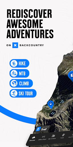
Are you an outdoor enthusiast seeking reliable navigation tools for your adventures? onX Backcountry Trail Maps GPS is the perfect companion to explore the great outdoors confidently. Whether you love hiking, mountain biking, climbing, or backcountry skiing, this powerful GPS map app offers everything you need to navigate and plan your trips with ease and safety.
Key Features of onX Backcountry
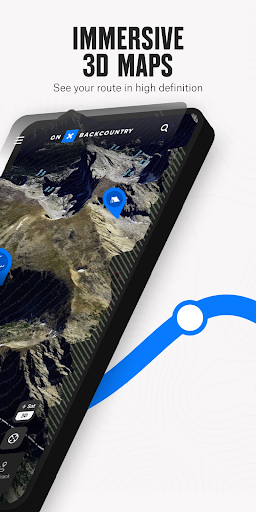
Comprehensive Trail and Terrain Mapping
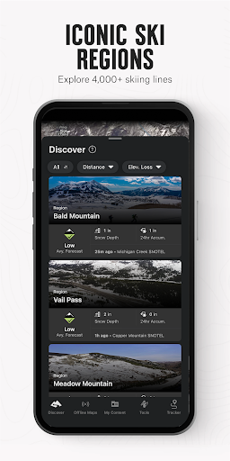
Discover 365,000+ miles of trails across the U.S., along with over 300,000+ rock climbing routes and 4,000+ ski lines. The app provides detailed topographic, satellite, and hybrid maps, which can be viewed in 3D to help you visualize terrain and measure elevation and distance accurately. These features enable outdoor lovers to scout new areas, review trail conditions, and plan trips with granular detail by setting Waypoints and accessing slope data like • Slope Angle, • Slope Aspect, and • Trail Slope.
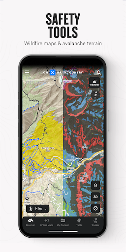
With toggleable map layers, you can even see • wildfires or • avalanche zones for safer adventure planning. This versatility makes onX Backcountry an invaluable tool for outdoor adventurers, providing reliable data to navigate confidently in unfamiliar terrain.
Offline Navigation & Real-Time Tracking
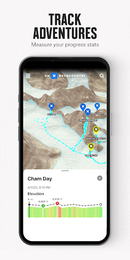
One of the standout features is the ability to download maps for offline use. This transforms your mobile device into a handheld GPS system, ensuring you stay on course even without cell service. The app tracks your location with a high degree of accuracy, showing a dynamic blue dot that guides you back to your starting point or along your planned route. Additionally, you can measure your trip stats, including distance traveled, elevation gained, and duration, making it a perfect tool to track your progress on outdoor adventures.
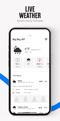
Weather and Safety Tools
Safety is crucial when exploring the wilderness, and onX Backcountry excels here by providing localized weather conditions, hourly wind forecasts, and 7-day weather forecasts. Stay ahead of changing weather patterns to hike, climb, ski, or bike safely. The app also features trail reports submitted by other users, offering real-time trail conditions and closures.
With layer options like • wildfire, • air quality, and • smoke density, you can monitor environmental hazards. Plus, the compass tool helps you orient yourself precisely in any outdoor setting.
Plan and Prepare Your Outdoor Adventures
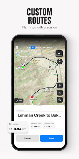
Planning your trip is seamless with onX Backcountry’s extensive database. Search for trails based on difficulty, activity type, or length. Whether it’s a quick mountain hike, a challenging rock climb, or multi-day ski routes, the app helps you craft a detailed itinerary. You can create custom routes with the snap-to-trail feature and set Waypoints for precise navigation.
Furthermore, review trail conditions and submit updates to inform others in the community. The app supports all four seasons, making it versatile for year-round adventures.
Special Layers and Premium Content
Elite and Premium Version Benefits
Upgrade to Premium or Elite for access to exclusive features, including:
- Over 650,000 miles of trails across various activities
- Detailed topographic maps and 3D views
- Public Land Layer covering 985 million acres
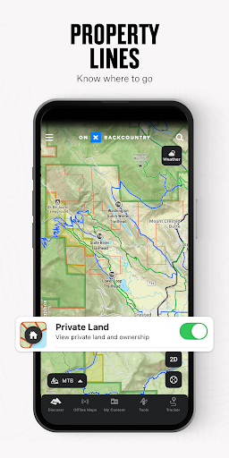
- Private land boundaries and land ownership details (Elite only)
- Recent satellite imagery up to two weeks old (Elite only)
Data sources include USFS, BLM, and NPS, ensuring trustworthy information for your adventures. Explore recreation icons like trailheads, campgrounds, and backcountry cabins to enhance your trip planning.
Getting Started and Community Support
Experience a 7-day free trial of the Premium or Elite features upon installing the app. This trial allows you to access all the top tools and data to prepare for your adventure. If you encounter issues or have ideas, the dedicated support team is just an email away, ensuring you get the most out of your experience.
In summary, onX Backcountry Trail Maps GPS is more than a navigation app—it's your all-in-one outdoor adventure toolkit. From planning routes and accessing detailed terrain data to staying safe with real-time weather info and trail conditions, this app puts comprehensive trail information at your fingertips. Download it today and gear up for your next outdoor expedition!
Pros
- Accessible offline trail maps
- Real-time weather updates for safe hiking
- Features for customizing routes
- Detailed topographic maps for various terrains
- Social sharing capabilities
Cons
- Premium features require a subscription
- Consumes significant battery during extended use
- Limited options for offline map downloads
- Occasional inaccuracies in GPS positioning
- User interface may be complex for beginners