
Discover HuntStand: GPS Maps & Tools
HuntStand is an innovative GPS maps and tools application designed specifically for outdoor enthusiasts, especially hunters. With its completely redesigned interface, HuntStand provides a seamless experience for scouting, navigation, and land management. Recognized as the Best App for Hunters by Outdoor Life Magazine, it has become North America’s #1 hunting and land management app with over 6 million downloads.
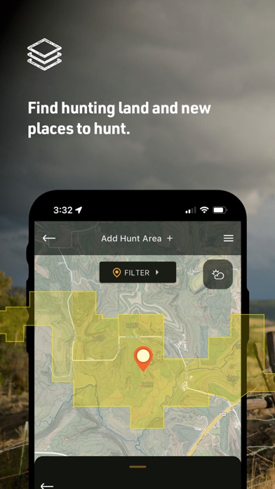
This versatile app is perfect for finding property lines, discovering new hunting spots, and tracking deer movement. Whether you're a seasoned hunter or a casual explorer, HuntStand offers powerful features that enhance your field experience. Best of all, it is available for free download, making it accessible for everyone eager to optimize their outdoor adventures.
Main Features of HuntStand
Popular Features
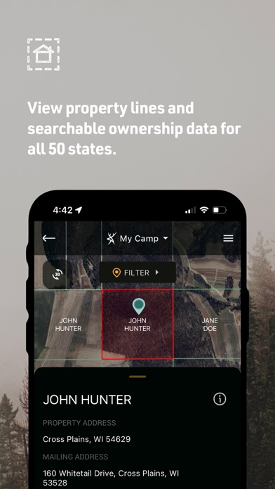
- Nationwide Property Lines: Access private and public property boundaries across all 50 states and most of Canada, with curated maps to help identify land ownership and boundaries.
- Advanced Whitetail Forecasts: Exclusive 15-Day Whitetail Activity Forecasts tailored to your exact location. This feature helps hunters determine the best times to pursue their target game.
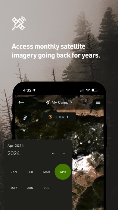
- Monthly Satellite Imagery: View updated satellite imagery each month, including a historical archive spanning multiple years. This allows users to observe changes and plan accordingly.
- Group Hunt Areas: Easily share your custom hunt areas with friends, lease partners, and family to coordinate your outdoor activities seamlessly.
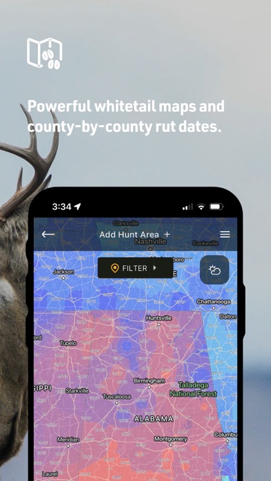
- Nationwide Rut Map: The only county-level whitetail rut map providing comprehensive rut dates, displayed through a clear color-coded system.
Core Functionalities
- GPS Mapping: Real-time tracking of your current position, path tracing, and marker placement for important locations like tree stands.
- HuntZone Wind Forecasting: Hour-by-hour scent impact predictions for up to 72 hours to optimize wind direction decisions.
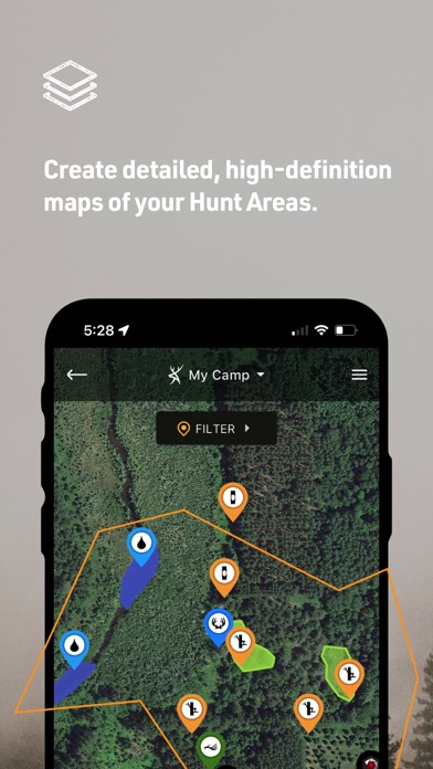
- Hunt Area Customization: Design detailed maps tailored to your specific hunting areas and share them with your hunting partners or family.
- High-Resolution Satellite: Access detailed imagery to plan routes and locate optimal hunting spots with precision.
- Digital Rangefinder: Accurately calculate distances in the field with the built-in rangefinder mode.
Upgrade to HuntStand Pro
For just $29.99 per year, HuntStand Pro offers an extensive suite of enhanced features. It includes all functionalities of the free app plus advanced mapping and data tools such as:
- Nationwide Property Lines and Property Ownership Data: View detailed property boundaries and ownership information across all 50 states and Canada.
- Monthly Satellite Imagery: Regular updates with historical archives for thorough land analysis.
- Public Hunting Land Maps: Discover and explore public hunting areas across regions.
- National Aerial Imagery: High-resolution aerial views of the entire U.S.
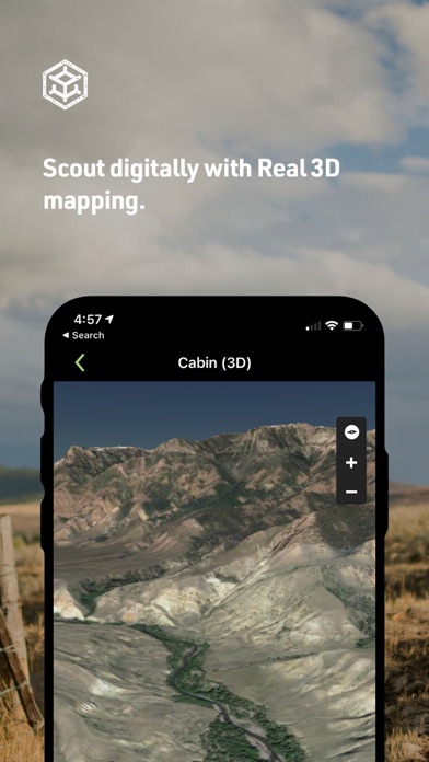
- 3D Mapping: Dynamic navigation experience allowing you to fly through terrains for better planning.
- Offline Maps: Save maps to use without internet access in remote locations.
HuntStand Pro Whitetail
For the ultimate deer hunting experience, upgrade to HuntStand Pro Whitetail. This version includes all HuntStand Pro features and tools specifically tailored for whitetail hunters, such as:
- 15-Day Whitetail Activity Forecast: Helps identify peak hunting times and predict deer movement with high accuracy.
- Annual Whitetail Rut Map: County-level rut data visualized through a color-coded map, detailing rut phases across regions in the U.S.
- Whitetail Habitat Map: Identifies ideal deer habitats for locating new hunting areas, specifically in the U.S.
Additional Information
HuntStand offers flexible subscription options. Charges are applied directly through your Google Play or app store account upon purchase. The privacy policy and terms & conditions can be reviewed at HuntStand Privacy Policy and Terms & Conditions.
Conclusion
Whether you’re out in the wild for hunting, land management, or exploring, HuntStand provides a comprehensive toolset that empowers outdoor enthusiasts. Its extensive mapping features, real-time weather updates, and land data make it an indispensable application for a successful and safe outdoor adventure. Download HuntStand today and experience the ultimate in navigation and land management technology—your all-in-one hunting companion in the field.
Pros
- Comprehensive map layers for hunting.
- User-friendly interface for navigation.
- Offline maps accessible in remote areas.
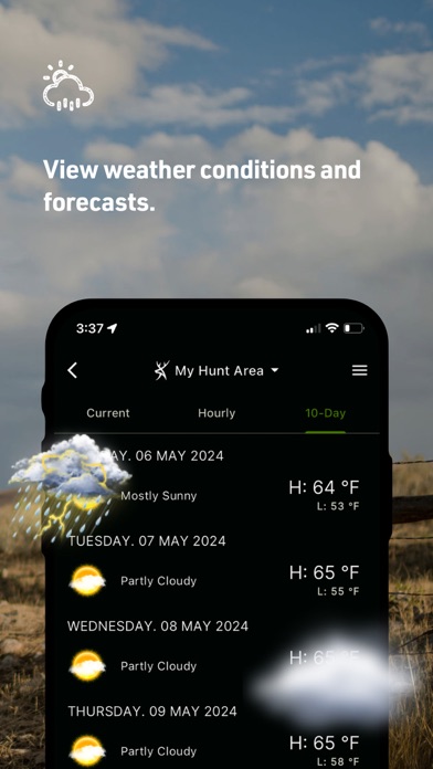
- Weather tracking specifically designed for hunters.
- Data synchronization across multiple devices.
Cons
- Some features require a premium subscription.
- Battery consumption increases due to GPS usage.
- Limited social community features.
- Occasional delays in loading maps.
- Incomplete coverage in certain regions.