Discover the World with Earth Map Satellite Live View
Are you eager to explore the globe from the comfort of your own space? The Earth Map Satellite Live View app transforms your device into a powerful window to the world, offering real-time satellite imagery and street view features that make virtual exploration both exciting and educational. Whether you're curious about bustling city streets, picturesque landscapes, or iconic landmarks, this app provides a seamless experience for globe-trotters, students, and curious minds alike.
Key Features of Earth Map Satellite Live View
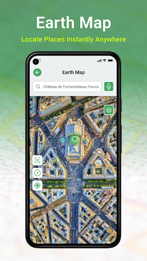
Real-Time Satellite View
One of the standout features of the Earth Map Satellite Live View app is its ability to display live satellite imagery from anywhere on Earth. Imagine zooming into the vibrant streets of Tokyo or the tranquil Swiss Alps in real time. This feature leverages the • GPS satellite system to present users with the latest views of the world's diverse landscapes, urban areas, and landmarks, all with astonishing clarity.
Intuitive User Interface
The app’s design is incredibly user-friendly, making navigation accessible even for those who aren't tech-savvy. The intuitive menu allows users to effortlessly switch between different viewing modes, such as satellite view and street view, enabling a truly immersive experience with minimal effort.
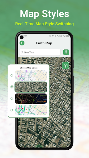
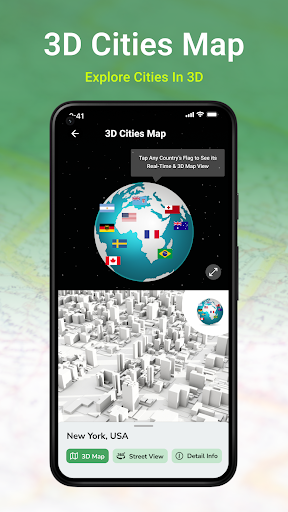
Zoom, Pan, and Explore
With seamless zoom and pan capabilities, users can dive deep into specific locations or glide across continents. Toggle between 2D and 3D views to get different perspectives, and discover detailed features like urban structures, natural terrains, and landmarks. This makes exploring the world both engaging and educational.
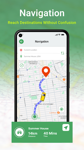
Live Navigation and Directions
The app enhances your virtual journey with live GPS navigation and voice-guided directions, helping users understand routes and distances effortlessly. The • navigational map feature supports real-time driving directions and suggests nearby places of interest, ideal for trip planning or discovering new locations.
Additional Tools and Features
Other notable features include a compass for orientation and a pedometer to track steps during virtual walks. These tools make the app multipurpose—it’s not just about exploring the earth but also about learning through interactive methods.
Why Choose Earth Map Satellite Live View
This versatile application stands out for its blend of functionality and ease of use. The live earth map in HD delivers high-quality images and real-time updates, providing an authentic experience. Its multifunctional design makes it suitable for various purposes, including educational use, travel planning, or simply satisfying your curiosity about the world's wonders.
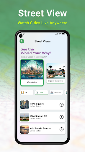
Virtual Travel and Educational Benefits
Ever dreamed of exploring the world from your living room? The Earth Map Satellite Live View app makes this possible, letting you virtually visit cities, landmarks, and natural wonders worldwide. Its detailed satellite and street views serve as great tools for learning geography, discovering new places, and planning future trips. Whether for students, teachers, or travel enthusiasts, this application turns travel into an engaging educational experience.
Conclusion
If you’re passionate about exploring and understanding more about our planet, Earth Map Satellite Live View is an essential app. It combines the latest satellite imaging technology with easy navigation, offering a real-time glimpse of the world at your fingertips. Download this app today and embark on a virtual journey across the globe, experiencing the beauty and diversity of Earth—all from the comfort of your device.
Pros
- High-resolution satellite imagery
- Real-time location tracking
- User-friendly navigation interface
- Street view feature
- Offline map availability
Cons
- Advertisements can be disruptive
- Limited features in the free version
- Occasional slow loading times
- Consumes battery rapidly
- Needs internet connection for live updates