

Discover the Power of AlpineQuest Off-Road Explorer
Are you an outdoor enthusiast seeking the ultimate navigation tool to enhance your adventures in the wild? Look no further than AlpineQuest Off-Road Explorer. This comprehensive app transforms your smartphone into a rugged, multifunctional trail companion, ensuring you stay oriented and prepared no matter where your outdoor pursuits take you. Designed for hikers, bikers, explorers, and off-road drivers alike, AlpineQuest offers a suite of features that make navigating remote terrains simple, reliable, and enjoyable.
Key Features of AlpineQuest Off-Road Explorer
Robust Offline Map Support
One of the standout benefits of AlpineQuest is its exceptional offline capabilities. You can download a wide variety of topographic maps—such as road, satellite, and terrain overlays—and access them without an internet connection. The app supports diverse map formats, including raster maps, GeoTiff, GeoPackage, and zipped tiles (MBTiles, TMS). This means your maps remain accessible even in the most remote locations, making AlpineQuest the perfect hiking, trail running, or off-road navigation companion when cell service is unavailable.
Accurate GPS & Directional Tools
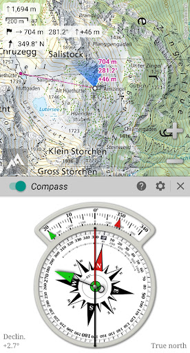
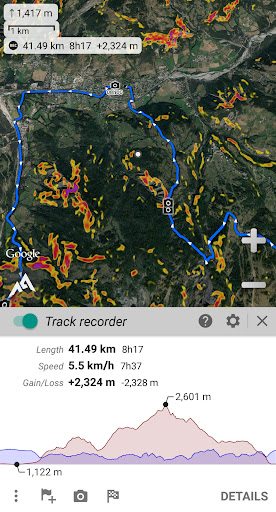
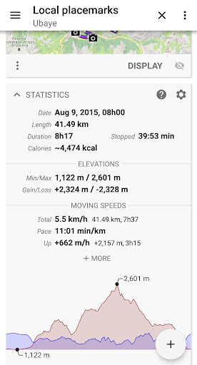
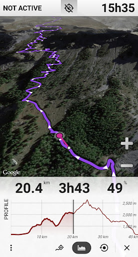
Stay on track with real-time GNSS positioning using your device’s GPS, Glonass, Galileo, or network services. The app offers a built-in compass, target finder, and map orientation features that allow you to determine your heading and find your way back even in unfamiliar territory. Long-term track recording, including altitude and network strength, helps you analyze your routes and ensure safety during extended excursions.
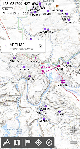
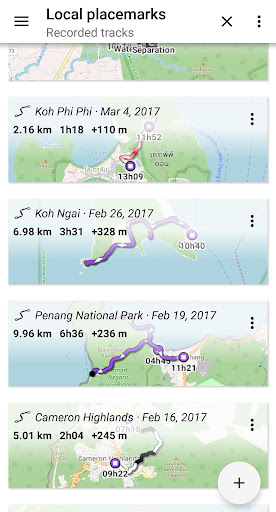
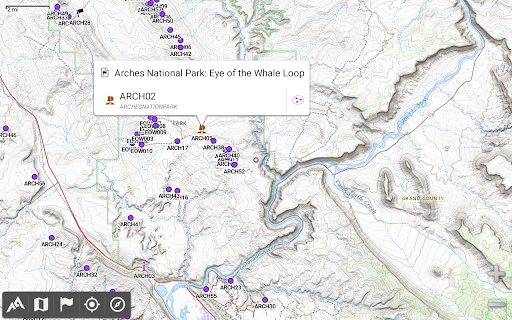
Flexible Placemarks & Route Planning
Create and manage an unlimited number of waypoints, routes, and areas. The app supports importing and exporting these data in GPX, KML, CSV, SHP, GeoJSON, and other formats, allowing seamless sharing and synchronization. Planning your trip is simplified with features like distance measurement, elevation profiles, and detailed statistics. Save favorite spots, mark trailheads, or share your favorite locations with friends directly from the app.
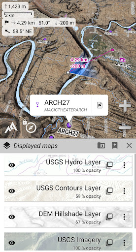
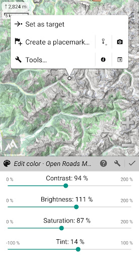
Advanced Map Customization & Visualization
Users can overlay multiple maps with adjustable opacity, contrast, and tint to tailor their view. Calibrate custom scans or images as maps, and utilize on-board digital elevation models (DEMs) to display terrain features such as hillshades and slopes. Support for polar maps makes AlpineQuest invaluable for polar expeditions or Arctic and Antarctic explorations.
Specialized Navigation & Tracking Features
The app leverages your device’s sensors to provide precise navigation aids and alerts, including proximity warnings and leaving-path notifications. Its long-duration track recorder runs efficiently in the background, storing geolocation and sensor data. Integrate barometric data to enhance elevation accuracy—ideal for mountain or altitude-based activities.
Why AlpineQuest Off-Road Explorer is a Must-Have
Designed with outdoor lovers in mind, AlpineQuest prioritizes privacy and reliability—there are no ads, data sharing, analytics, or third-party libraries. This ensures your data remains private, and the app functions fully even far from cellular towers or internet access. Whether you're hunting, sailing, geocaching, or trail running, AlpineQuest empowers you with detailed maps, comprehensive navigation tools, and extensive customization options. Its ability to support numerous coordinate formats and interchangeable map types makes it suitable for global adventures and specialized activities alike.
Conclusion
If you're serious about exploring the great outdoors, AlpineQuest Off-Road Explorer is an indispensable tool that combines professional-grade features with easy usability. Its offline mapping, real-time GPS tracking, and versatile data management make it ideal for wilderness explorers, mountain climbers, or off-road drivers seeking a reliable navigation aid. Don't let unpredictable terrains or lack of reception hold you back—download the free Lite version today and start your adventure with confidence. Remember, every outdoor journey is safer and more enjoyable with AlpineQuest guiding your way.
Pros
- Offline maps available
- Customizable interface
- Accurate GPS tracking
- Supports various map formats
- Easy waypoint management
Cons
- Complex for beginners
- Paid features locked
- High battery usage
- Occasional bugs
- Limited customer support


