

Discover the Power of OruxMaps GP for Outdoor Adventures
If you're passionate about exploring the great outdoors, OruxMaps GP is an essential tool that can elevate your journey. This versatile navigation application is designed to support outdoor activities such as hiking, biking, boating, and more, offering both online and offline mapping capabilities. Its comprehensive features make it stand out as a top choice for adventurers seeking reliable and detailed navigation solutions.
Key Features of OruxMaps GP
Extensive Map Support
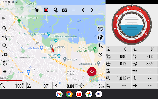
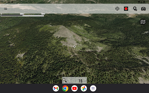
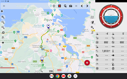
One of the standout features of OruxMaps GP is its support for a wide variety of map formats. You can access and utilize maps in formats like GeoPDF from the USGS store, GeoTIFF maps, .ozf2, .img Garmin vector maps (note: full support may vary), .mbtiles, and others. The app excels at both online and offline maps, allowing users to download maps for offline use when cellular connectivity is limited. Keep in mind that not all online map sources are available for download—select alternative sources if needed. Recently added are integrated support for Mapbox and Google online maps, accessible via subscription, providing users with richer cartographic options.
Online Connectivity and Mapping
With OruxMaps GP, you can enjoy features like WMS and WMTS online map viewing, as well as download maps for offline navigation. While registering for an account on the app's servers is optional, doing so enables additional functionalities like multitracking and position sharing with contacts via email. User data such as email, date of birth, and personal stats are stored securely and can be deleted upon account removal, ensuring user privacy.
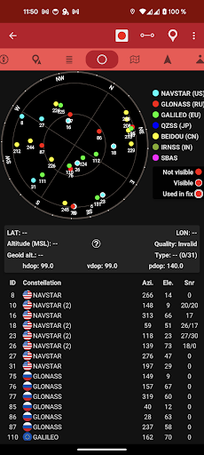
Device Compatibility and External Sensor Support
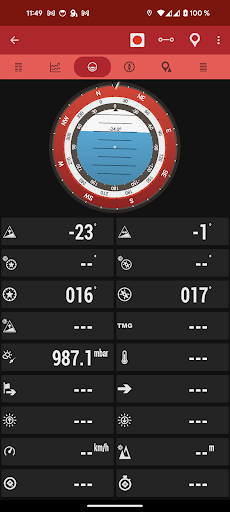
The app offers support for multiple external devices including GPS units, heart rate monitors (including Bluetooth 4.0 devices), bike cadence, speed sensors, cycle power meters, and ANT+ devices. It can also connect to nautical AIS systems via Wi-Fi, Bluetooth, or USB, making it suitable for marine navigation.
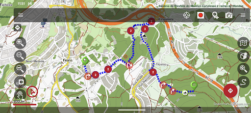
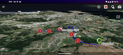
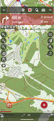
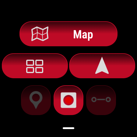
Advanced Route and Track Management
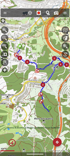
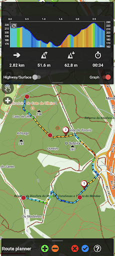
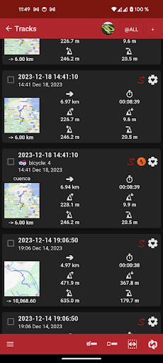
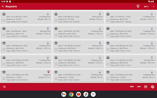
Users can view, create, and edit routes and tracks in various formats such as KML, KMZ, TCX, FIT, CSV, SHP, and GPX. The app supports sharing your location, displaying friends' positions, and setting alarms for proximity alerts or deviations from routes. Create custom waypoints with personal icons, attach multimedia files, and add custom forms, enhancing navigation customization.
Additional Functionalities
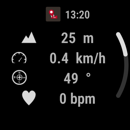
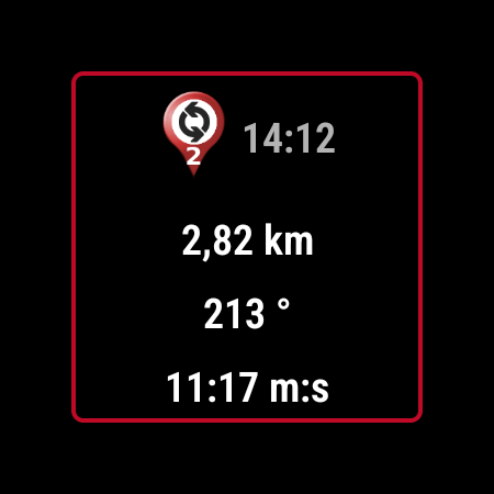
Support for Geocaching and altitude correction using DEM files either offline or via online services makes OruxMaps GP a powerful tool. The track editor feature allows modification of track points, ensuring accurate data. You can search and download tracks from sources like GPSies or generate routes using online services like Graphhopper or Brouter. The app also includes a Wear OS version for quick access to navigation data on your smartwatch.
Explore OruxMaps GP for Seamless Outdoor Navigation
Designed for adventurers of all levels, OruxMaps GP offers an intuitive yet feature-rich experience. Its support for diverse map formats, external devices, and detailed route management makes it a comprehensive navigation companion. Whether you're planning a remote hiking trip or cycling through scenic routes, this app provides reliable tools to keep you on track and enhance your outdoor explorations.
Its ability to download offline maps ensures you won't get lost in remote areas with poor connectivity. The app's customization options, including waypoints with multimedia attachments and custom icons, allow users to personalize their navigation experience. With regular updates adding new map sources and features, OruxMaps GP continues to be a favorite among outdoor enthusiasts who demand precision and versatility in their navigation apps.
Overall, OruxMaps GP combines powerful features with ease of use, making it an invaluable tool for hikers, bikers, sailors, and nature lovers alike. If you're looking for a reliable, feature-packed mapping app to accompany your adventures, give OruxMaps GP a try and transform how you explore the outdoors.
Pros
- Highly customizable settings.
- Supports offline maps.
- Offers a wide range of map sources.
- Provides detailed GPS tracking features.
- Receives frequent updates and improvements.
Cons
- Steep learning curve.
- Design is not very user-friendly.
- Some features require payment.
- Occasional issues with GPS accuracy.
- Complex interface can be challenging for beginners.